

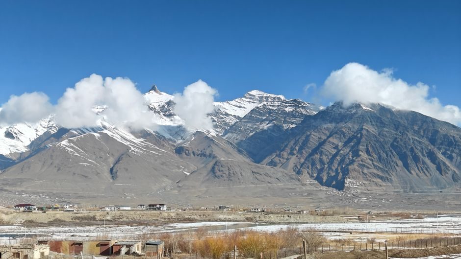

Kaza to Chandratal Distance: Your 2026 Route Guide
The kaza to chandratal distance sits at roughly 65 kilometres, but that number tells you almost nothing useful. I’ve driven this stretch twice, and both times the journey took wildly different amounts of time. Once it was four hours. Another time, nearly seven. The road conditions, weather, and whether you get stuck behind a convoy of trucks hauling supplies to remote villages all play their part.
What most travel blogs won’t tell you is that this isn’t really about distance. It’s about elevation, unpredictable terrain, and the Kunzum Pass sitting between you and that crescent-shaped lake at 4,300 metres. If you’re planning a Chandratal trip from Kaza in 2026, here’s what actually matters.
Understanding the Actual Route from Kaza to Chandratal
You’ve got exactly one road option. From Kaza, you’ll head towards Losar village, then climb up to Kunzum La (pass) at 4,551 metres, before descending towards the Chandratal turn-off. The total distance breaks down like this: Kaza to Losar is about 54 km on relatively decent tarmac. Losar to Kunzum Pass adds another 16 km of increasingly rough terrain. From Kunzum, it’s a 14 km diversion off the main Manali-Kaza highway to reach the lake.
Here’s where it gets interesting. That 14 km diversion to Chandratal is the most brutal section. The road, if you can call it that, is essentially a rocky trail with sections that wash away every monsoon. Your average speed here drops to about 10-15 km per hour.
The Kunzum Pass Factor
Kunzum La isn’t just a geographic feature on your route. It’s the single biggest variable in your travel time. The pass opens typically by mid-June and closes by mid-October, though 2026 dates will depend entirely on snowfall patterns. Even when open, morning fog can reduce visibility to almost nothing, and afternoon winds make the exposed sections genuinely challenging.
I recommend crossing Kunzum before 10 AM or after 4 PM. Midday brings the worst combination of tourist traffic and weather uncertainty. The temple at the pass is worth a quick stop, but don’t linger if clouds are rolling in.
How Long Does the Kaza to Chandratal Journey Take?
Plan for 4 to 5 hours of actual driving time under good conditions. Add buffer time for photo stops, the mandatory Kunzum temple pause, and the inevitable moments where you’ll need to wait for oncoming vehicles on single-track sections. Most travellers end up spending 6 hours door to door.
The question people often ask is whether they can do Chandratal as a day trip from Kaza. Technically, yes. Practically, it’s exhausting and you’ll miss the best parts. The lake transforms completely at dawn and dusk. A rushed afternoon visit gives you maybe two hours at the site before you need to head back.
Best Vehicle Options for This Spiti Valley Route
Your choice of vehicle matters more here than almost anywhere else in Himachal Pradesh. SUVs with high ground clearance handle the rocky patches without drama. Mahindra Thars, Toyota Fortuners, and Isuzu D-Max pickups are the workhorses you’ll see most often. Sedans and hatchbacks can technically make it, but a single badly placed rock can end your trip with an oil pan puncture.
Renting a vehicle in Kaza runs between 3,500 to 5,000 rupees for a day trip with driver, depending on the vehicle type and your negotiation skills. The driver’s local knowledge is worth the premium over self-driving, especially if it’s your first time on this route.
Fuel Considerations
Fill your tank completely in Kaza. There’s no petrol pump between Kaza and Chandratal, and the next reliable option towards Manali is at Tandi, over 100 km from the lake. The Kaza petrol pump sometimes runs out of fuel during peak season, so don’t push your luck by arriving with a quarter tank.
When to Travel: Seasonal Road Conditions
The Kaza to Chandratal road operates on a strict seasonal window. June through September offers the most reliable access, with July and August being the warmest months. However, July also brings occasional rain that can make the Chandratal approach road treacherous.
September sits in a sweet spot. The monsoon has usually retreated, the crowds thin out after the August rush, and the landscape takes on golden hues. Early October is risky. Snow can arrive without warning, and the road closes within days once it starts.
What about travelling during monsoon season? The answer is straightforward: don’t. Landslides are common on the Losar to Kunzum stretch, and getting stranded with a blocked road behind you and another ahead isn’t anyone’s idea of adventure.
Accommodation Options Along the Route
You’ve got three realistic choices. Stay in Kaza before your trip, camp near Chandratal, or push through to Batal. Each has trade-offs.
Kaza offers proper hotels with attached bathrooms, hot water, and reliable electricity. Places like Hotel Deyzor and Zostel Kaza provide comfortable bases. The downside is the early morning start required to reach Chandratal at a reasonable hour.
Chandratal camping has become heavily regulated. The campsites sit about 2 km from the lake to protect the fragile ecosystem. Expect basic tents, shared toilet facilities, and prices around 2,000 to 3,000 rupees per person including meals. Paradise Camps and Moonland Camps are established operators, though new camps appear each season.
The Camping Experience
Staying overnight near Chandratal remains the best way to experience the lake. Temperatures drop to near freezing even in August, so bring proper layers regardless of how warm Kaza felt. The stars at this altitude, without any light pollution, are genuinely extraordinary. I saw the Milky Way more clearly here than anywhere else in India.
Altitude Sickness and Health Precautions
Both Kaza (3,650 metres) and Chandratal (4,300 metres) sit at elevations where acute mountain sickness becomes a real concern. If you’ve acclimatised in Kaza for a day or two before heading to the lake, you’ll likely be fine. Problems arise when people fly into Delhi, drive non-stop to Spiti, and immediately attempt high-altitude excursions.
Symptoms to watch for include persistent headache, nausea, dizziness, and unusual fatigue. The solution is always descent. Chandratal is not the place to tough it out. Medical facilities are non-existent at the lake, and the nearest proper hospital is in Keylong or Manali, hours away.
Carry Diamox if your doctor recommends it, but don’t treat it as a substitute for proper acclimatisation. Hydration helps significantly. The dry mountain air dehydrates you faster than you realise.
Permits and Entry Requirements for 2026
Indian nationals don’t need permits for Chandratal as of current regulations. Foreign nationals require an Inner Line Permit, obtainable from the District Magistrate’s office in Kaza or Reckong Peo. The process has moved partially online, but having a printed copy remains essential since checkpoints often lack internet connectivity.
The Himachal Pradesh Forest Department collects an entry fee at the Chandratal approach. Keep your receipt. Random checks happen, and losing the slip creates unnecessary hassle.
What to Expect at Chandratal Lake
The lake itself spans roughly 2.5 km in circumference. A walking trail circles most of it, though some sections get muddy after rain. The water colour shifts throughout the day. Early morning gives you deep blues and greens. Midday sun washes things out. Late afternoon brings back the drama.
Swimming is prohibited and genuinely dangerous. The water temperature hovers around 5-8 degrees Celsius even in summer. People have died attempting to swim here. The lake holds religious significance for local Buddhists, so respectful behaviour is expected.
Pack out all your trash. This applies everywhere, but especially here. The fragile high-altitude ecosystem takes decades to recover from careless littering, and I’ve seen pristine spots ruined by previous visitors’ garbage.
Alternative Routes to Consider
Coming from Manali instead of Kaza offers a different perspective. The Manali to Chandratal distance via Rohtang and Batal is approximately 110 km, and this approach lets you avoid doubling back. Many travellers do a loop: Manali to Chandratal to Kaza, or vice versa, covering both major Spiti Valley attractions.
The Manali route, however, involves the Rohtang Atal Tunnel and then the notoriously rough Gramphu-Batal road. Road conditions here are often worse than the Kaza side, with water crossings that can stop traffic for hours.
Final Planning Notes
Book your Chandratal camps at least two weeks in advance during July and August. Carry cash since card machines don’t exist past Kaza. Phone signals disappear after Losar and don’t return until you’re back on the main road. Download offline maps before you leave Kaza.
The 65 km from Kaza to Chandratal will test your patience and reward it in equal measure. This isn’t a drive you rush through. It’s the kind of journey where the destination and the path blur together into something worth remembering.
0 Comment