

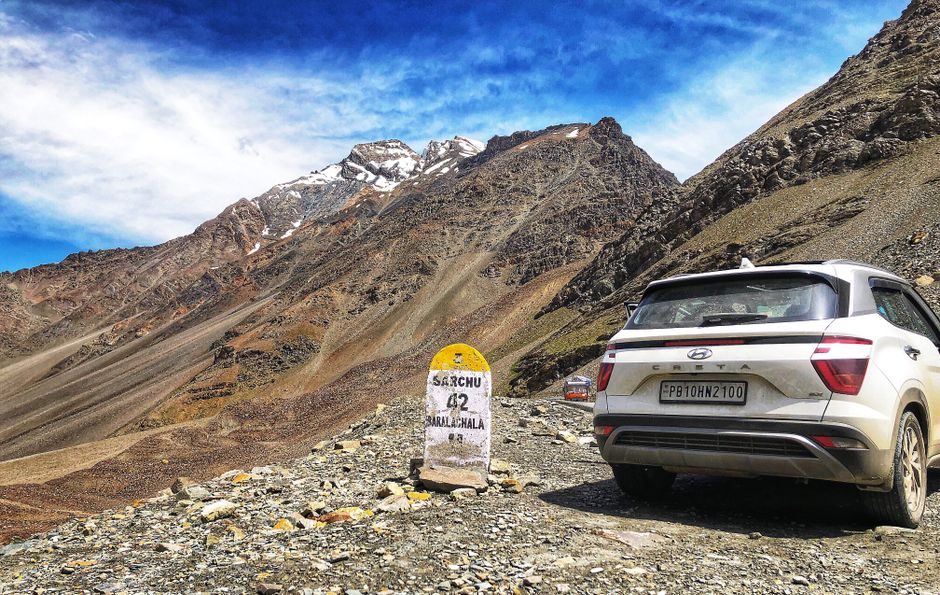

Manali to Baralacha Pass Distance and Route
The Manali to Baralacha Pass distance is approximately 222 kilometres, but that number tells you almost nothing about what you’re actually signing up for. I’ve driven this stretch three times now, and each trip took anywhere from 7 to 11 hours depending on road conditions, military convoys, and whether the Rohtang tunnel was having one of its moody days. This isn’t a distance you measure in kilometres. You measure it in altitude gained, hairpin turns survived, and the exact moment your ears start popping near Keylong.
Baralacha La sits at 16,040 feet, making it one of the highest motorable passes on the Manali-Leh Highway. The route takes you through some of the most dramatic landscapes in the Indian Himalayas, but it also demands respect. Underestimate it, and you’ll find yourself stranded at Zing Zing Bar with a busted radiator and no mobile signal.
Complete Route Breakdown from Manali to Baralacha Pass
Your journey starts from Manali’s Mall Road at roughly 6,500 feet elevation. The first 50 kilometres through the Atal Tunnel bypass the old Rohtang Pass route entirely, saving you about 4-5 hours of hairpin agony. After exiting the tunnel at Sissu in the Lahaul Valley, you’re already at 10,000 feet with 172 kilometres still ahead.
From Sissu, the road follows the Chandra River through Tandi and reaches Keylong at kilometre 115. Keylong is the last proper town with ATMs, medical facilities, and decent food options. Beyond Keylong, you pass through Jispa at kilometre 137, then Darcha at kilometre 145. The final 77 kilometres from Darcha to Baralacha Pass are where things get interesting, with the road climbing aggressively through Patseo and Zingzingbar.
Kilometre by Kilometre Distance Chart
Manali to Atal Tunnel North Portal: 25 km. Tunnel exit at Sissu: 50 km total. Sissu to Keylong: 65 km more, bringing you to 115 km. Keylong to Jispa: 22 km. Jispa to Darcha: 8 km. Darcha to Baralacha Pass: 77 km. Total: 222 km from Manali town centre.
How Long Does It Take to Drive This Route
Budget 7-9 hours for the drive if conditions cooperate. The Atal Tunnel has strict speed limits and single-lane sections during maintenance, which happens more often than the official websites admit. Military convoys between Darcha and Baralacha Pass can add 30-90 minutes of waiting time, especially during summer deployment season.
I once sat for 47 minutes at the Darcha checkpoint because a BRO team was clearing a minor landslide near Patseo. There’s no alternative route, no cell signal to complain to anyone, and nothing to do except watch marmots judge you from the hillside. Leave Manali by 5 AM if you want to cross Baralacha Pass before afternoon clouds roll in.
Best Time to Travel from Manali to Baralacha Pass
The route opens in late May and closes by mid-October, though exact dates depend on snowfall. June offers stable weather but crowded roads. September is my preferred window because the tourist rush has thinned out, temperatures are still manageable, and the landscape has that golden-brown autumn tinge that photographs beautifully.
July and August bring monsoon complications. The Lahaul Valley itself doesn’t get heavy rain, but the Rohtang side of the Atal Tunnel can experience landslides that delay tunnel operations. I’d avoid the first two weeks of August specifically. The Himachal Pradesh PWD website posts road status updates, though checking with Keylong-based drivers on Facebook groups gives you more accurate real-time information.
Fuel and Emergency Stops Along the Way
Fill your tank completely at Manali. There’s an HP petrol pump at Tandi, roughly 88 km from Manali, but it runs out of petrol more often than you’d expect. Keylong has two pumps that are generally reliable. After Keylong, there’s nothing until Pang, which is 90 km past Baralacha Pass.
Carry 10 litres of extra petrol in jerry cans if you’re driving a vehicle with fuel efficiency below 12 kmpl. This isn’t paranoia. I’ve helped push three stranded cars in the Sarchu-Baralacha section because drivers assumed “full tank from Manali” would cover 400+ km of mountain driving. It doesn’t. Your mileage drops 30-40% at these altitudes.
Food and Accommodation Options
Keylong has the Hotel Deyzor and Hotel Tashi Delek for proper rooms. Jispa offers tented camps like Padma Lodge and Ibex Camp that operate from June to September. Beyond Jispa, your only option is the HPTDC tent accommodation at Sarchu, which is 50 km past Baralacha Pass. Don’t plan to stay overnight at Baralacha Pass itself unless you’re carrying serious cold-weather gear. Temperatures drop to minus 5 even in July.
Road Conditions and Vehicle Requirements
The stretch from Darcha to Baralacha Pass includes the infamous Gata Loops, a series of 21 hairpin bends that climb 1,200 feet in 12 kilometres. The road surface varies from decent tarmac near Keylong to broken asphalt and gravel patches between Zingzingbar and the pass. After snowfall or rain, water crossings or nallahs at certain points can reach 1-2 feet deep.
Any vehicle with decent ground clearance handles this route. Sedans struggle at the water crossings and the unpaved sections, but I’ve seen Maruti Swifts and even Hyundai i20s make it through in good weather. SUVs like the Mahindra Thar, Toyota Fortuner, or Tata Safari are obviously more comfortable. Motorcyclists should ensure their bikes have been serviced recently because carburetted engines lose significant power above 14,000 feet.
Altitude Sickness and Health Precautions
Baralacha Pass at 16,040 feet can trigger acute mountain sickness in people who haven’t acclimatized. The smart approach is spending at least one night in Keylong or Jispa before attempting the pass. If you drive straight from Manali to Baralacha Pass in a single day, you’re gaining nearly 10,000 feet of altitude in 6-8 hours, which is asking for headaches, nausea, or worse.
Diamox (Acetazolamide) helps prevent altitude sickness, but consult a doctor before taking it. Carry Disprin for headaches, ORS packets for dehydration, and Avomine if you’re prone to motion sickness. The combination of altitude and 200+ kilometres of curves makes even seasoned travellers queasy.
Permits and Documentation Needed
Indian citizens don’t need special permits for the Manali to Baralacha Pass route. However, if you’re continuing to Leh, you’ll need an Inner Line Permit for certain areas beyond Sarchu. Foreign nationals require a Protected Area Permit for the Manali-Leh Highway, obtainable from the District Magistrate office in Manali or through registered tour operators.
Carry your original vehicle registration certificate, driving licence, insurance papers, and pollution certificate. Checkpoints at Darcha and Pang verify these documents. Photocopies don’t work. I’ve watched tourists argue with ITBP personnel about this, and it never ends well for the tourists.
What Makes Baralacha Pass Worth the Effort
Baralacha Pass marks the intersection of three mountain ranges and three watersheds. The Chandra, Bhaga, and Yunam rivers all originate within 15 km of this spot. The pass connects Lahaul to Ladakh and Zanskar, making it historically significant for trade routes that predate motorable roads by centuries. Suraj Tal, a glacial lake just 3 km before the pass, reflects the surrounding peaks in a way that makes the drive worth every pothole.
The landscape shifts dramatically as you approach. Lahaul’s green valleys give way to brown and grey moraines. The air gets thinner and colder. Prayer flags at the pass snap violently in winds that never seem to stop. It’s not comfortable. It’s not easy. That’s exactly the point.
Common Mistakes to Avoid on This Route
Overconfidence kills more trips than bad weather. Don’t attempt the Manali to Baralacha Pass drive if you arrived in Manali the same morning from Delhi. Your body needs at least 24 hours to adjust even to Manali’s 6,500-foot elevation. Don’t skip the extra fuel. Don’t assume your phone will work beyond Keylong because it won’t. BSNL has the best coverage, but even that drops dead after Jispa.
Respect the BRO workers who maintain this road. Stop for convoys. Don’t honk at the sheep that block the road near Zingzingbar. They were here long before the highway was.
0 Comment