

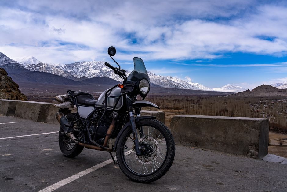

Ladakh Bike Trip Map: A Rider’s Planning Guide
I’ve seen too many riders print a basic Ladakh bike trip map, stuff it in their tank bag, and assume they’re ready. They’re not. A proper route map for Ladakh isn’t just about Point A to Point B. It’s about knowing where you’ll find fuel at 14,000 feet, which stretches have zero mobile network for 80 kilometers, and where that unmarked Army checkpoint will ask for your permits.
This guide breaks down the actual mapping you need before twisting the throttle toward the Himalayas. Not the romanticized version. The practical one that keeps your bike running and your lungs working at altitude.
Understanding the Two Primary Route Maps
Every Ladakh motorcycle journey follows one of two main corridors, and your map planning depends entirely on which direction you’re approaching from. The Manali-Leh Highway covers 479 kilometers and typically takes two riding days. The Srinagar-Leh Highway stretches 434 kilometers and can be done in a long single day, though I’d never recommend it.
Most experienced riders use the loop approach. They enter via Manali, exit via Srinagar, or vice versa. This means your map needs to account for both routes, not just one. The Manali route opens around mid-June and closes by late September, while the Srinagar route stays accessible from April through November in most years.
Manali-Leh Route Breakdown
Your map should mark these critical points: Manali (2,050m) to Rohtang Pass (3,978m) is just 51 kilometers but takes three hours with traffic. From Rohtang, you descend to Gramphu, then climb to Batal. The stretch from Batal to Chandratal Lake turnoff is where most riders stop on Day One, covering roughly 130 kilometers.
Day Two pushes through Baralacha La (4,890m), Nakee La, Lachulung La, and finally the notorious Gata Loops, a series of 21 hairpin bends climbing to 4,190 meters. Your map should specifically highlight the 22 kilometers between Pang and More Plains. This is the highest motorable plateau you’ll cross, sitting at 4,730 meters with zero shelter options.
Fuel Stop Mapping: The Non-Negotiable Layer
Here’s where generic maps fail riders completely. Fuel stations in Ladakh aren’t like the rest of India. They’re spaced 100-150 kilometers apart, operate on unpredictable schedules, and sometimes run dry for days. Your Ladakh bike trip map must include every verified fuel point with distance calculations from each.
On the Manali-Leh route, fuel is available at Tandi (the last reliable pump before Leh), then nothing until Upshi or Karu. That’s a 365-kilometer gap. Most bikes can’t cover this on a single tank. You’ll need to carry extra fuel, typically 5-10 liters depending on your motorcycle’s efficiency.
Current Fuel Points for 2026
The Srinagar route offers better fuel access. Stations at Sonamarg, Drass, Kargil, and Lamayuru break the journey into manageable segments. Kargil has the most reliable supply since it’s a military town with consistent logistics. I’ve heard from riders in 2026 who found the Mulbekh pump closed for weeks due to supply issues, so always fill up at Kargil regardless.
For Nubra Valley excursions, Diskit has one fuel station, but it runs out frequently during peak season. Top off in Leh before heading north over Khardung La. The round trip to Turtuk and back exceeds 300 kilometers.
Altitude Markers Your Map Must Show
Generic navigation apps show elevation, but they don’t help you plan acclimatization stops. Acute Mountain Sickness hits most riders somewhere between 3,500m and 4,500m. Your map needs to visually segment zones so you can pace your ascent properly.
The dangerous pattern I’ve witnessed: riders push from Manali (2,050m) directly to Sarchu (4,290m) on Day One. That’s a 2,200-meter altitude gain in eight hours. The headaches start around 2 AM. By morning, some can’t ride. A properly mapped route includes overnight stops that limit daily altitude gain to under 1,000 meters where possible.
Recommended Acclimatization Points
From Manali, stop at Keylong (3,080m) if you need extra adjustment time. Jispa (3,200m) offers better accommodation options. From either point, pushing to Sarchu or Pang the next day gives your body time to adapt. Leh itself sits at 3,500m, and most riders spend at least one full rest day there before attempting higher passes like Khardung La (5,359m) or Chang La (5,360m).
Permit Zones and Checkpoint Mapping
Your map should clearly mark the Inner Line Permit (ILP) zones. Indian citizens need ILPs for Nubra Valley, Pangong Lake, Tso Moriri, and several other restricted areas. The permits are obtained in Leh, but your route planning should account for which areas require which documents.
Army checkpoints appear at Khardung La top, before Nubra Valley entry, at Tangtse (before Pangong), and multiple points along the Hanle road. Each checkpoint logs your permit details and vehicle registration. The Pangong Lake route via Chang La has a checkpoint at Durbuk where queues can stretch for an hour during peak season.
Mobile Network Dead Zones to Mark
Offline maps aren’t optional for Ladakh. They’re mandatory. I use Organic Maps and download the entire Ladakh region before leaving home. Google Maps works in offline mode but consumes more battery. Your phone becomes your backup navigation when landmarks disappear into identical brown mountains.
Complete network blackout zones include: Baralacha La to Sarchu (approximately 50 kilometers), Pang to Upshi (roughly 85 kilometers), Khardung La north face to Khalsar (40 kilometers), and most of the Hanle route after Mahe. BSNL postpaid works best across Ladakh. Jio has expanded coverage significantly but still drops in remote passes.
Seasonal Route Variations
The Ladakh you map in June looks different from the one in September. Early season (June) means snow walls at Baralacha La and potential water crossings at Zingzingbar. The Pagal Nala stream crossing near Sarchu can be impassable before 8 AM when snowmelt is lowest. Late season (September) brings clearer roads but shorter daylight hours and colder nights.
The Manali route’s Atal Tunnel has permanently eliminated the Rohtang Pass drama for southbound traffic entering Lahaul. But returning riders heading to Manali still face Rohtang Pass traffic unless they’re exiting via Srinagar. Your map should note that the tunnel cuts 46 kilometers and about three hours from the journey compared to the old Rohtang crossing.
Creating Your Custom Route Layers
Google My Maps allows you to create custom layers marking all the points mentioned above. I recommend building four separate layers: fuel stops with distances between each, altitude markers with overnight stay options, permit checkpoints with document requirements, and network dead zones with kilometer markers.
This multi-layer approach lets you toggle information based on what you need at any moment. When you’re riding, fuel and altitude matter most. When you’re planning in Leh for the next day’s excursion, permits become the priority layer.
Recommended Digital and Physical Map Tools
Carry a physical backup. The Eicher Ladakh map costs around Rs 300 and shows all major routes with elevation profiles. It won’t help you navigate water crossings, but it provides big-picture context when your phone dies. The Survey of India topographic sheets offer extreme detail but are harder to source and read on the move.
Route Distances for Common Ladakh Circuits
Here’s the practical math for itinerary planning. Leh to Nubra Valley via Khardung La: 125 kilometers, allow five hours. Nubra (Hunder) to Pangong Lake via Shyok route: 180 kilometers, six to seven hours. Pangong to Leh via Chang La: 160 kilometers, five hours. Leh to Tso Moriri via Chumathang: 240 kilometers, seven to eight hours.
The Sham Valley circuit (Leh-Lamayuru-Leh) covers approximately 230 kilometers round trip and makes an excellent acclimatization ride before tackling higher passes. Most riders underestimate this loop because it seems “easy” compared to Khardung La, but Fotu La (4,108m) and Namika La (3,700m) on this route still demand respect.
What Your Final Map Should Include
Before you leave home, your Ladakh bike trip map should contain: every fuel point with current operational status verified through rider groups, altitude profiles for each day’s riding segment, permit zone boundaries, major checkpoint locations, recommended overnight stops with accommodation options (hotels in Kargil and Leh, camps at Sarchu and Pangong), and emergency contact numbers for the ITBP and local police stations.
The riders who struggle in Ladakh aren’t the ones lacking fitness or motorcycle skills. They’re the ones with incomplete maps and optimistic assumptions. Build your route properly before you leave, and Ladakh becomes challenging in all the right ways instead of the preventable ones.
0 Comment